
Robotics and Automation in Environmental Monitoring and Conservation
Robotics in environmental monitoring refers to the use of programmable machines that can perceive, reason, and act in natural settings to collect data, perform interventions, or support research activities. These machines range from small g…
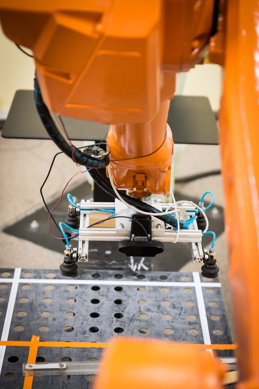
Robotics in environmental monitoring refers to the use of programmable machines that can perceive, reason, and act in natural settings to collect data, perform interventions, or support research activities. These machines range from small ground‑based rovers that crawl through forest litter to large autonomous vessels that patrol coastal waters. The core advantage of robotics is the ability to reach places that are hazardous, inaccessible, or too time‑consuming for human field teams. By combining mechanical design, electronics, and software, robots become platforms for systematic, repeatable, and high‑resolution observations.
Automation complements robotics by providing the logic and processes that allow machines to operate with minimal human supervision. In the context of environmental conservation, automation encompasses everything from the scheduling of sensor deployments to the real‑time processing of collected data. For instance, an automated workflow might trigger a drone flight whenever a river gauge detects a sudden rise in water level, ensuring that aerial imagery is captured precisely when flood risk peaks.
Sensor technology is the foundation of any monitoring system. Sensors convert physical phenomena—such as temperature, humidity, chemical concentration, or acoustic pressure—into electrical signals that can be recorded and analyzed. In environmental robotics, common sensors include temperature probes, pH meters, multispectral cameras, LIDAR scanners, and acoustic hydrophones. The choice of sensor depends on the specific parameter of interest and the operational environment. For example, a high‑resolution LIDAR unit mounted on a UAV can generate three‑dimensional point clouds of forest canopy structure, enabling the estimation of biomass and carbon storage.
Actuator components translate control commands into physical motion. Typical actuators in field robots are electric motors, hydraulic cylinders, and piezoelectric elements. The precision and power of an actuator determine how well a robot can navigate challenging terrains, manipulate objects, or maintain a stable platform for delicate measurements. A ground robot tasked with collecting soil samples may use a linear actuator to lower a corer into the ground, while a marine autonomous vehicle employs thrusters to counteract currents and keep a sensor array steady.
Drone is a colloquial term for an unmanned aerial vehicle (UAV). Drones have become indispensable tools for rapid, high‑resolution mapping of large or remote areas. Their ability to fly at low altitude permits the capture of fine‑scale imagery that satellite platforms cannot provide. In conservation, drones equipped with thermal cameras can locate poaching activity at night, while those carrying hyperspectral sensors can differentiate between healthy and stressed vegetation based on subtle spectral signatures.
Unmanned ground vehicle (UGV) denotes autonomous or remotely operated platforms that travel over land. UGVs are particularly useful in dense forests, wetlands, or mountainous regions where aerial access is limited. A typical UGV for wildlife monitoring might carry a suite of cameras, a LiDAR scanner, and a sound recorder, moving along pre‑programmed transects to document animal presence and habitat features. The vehicle’s navigation system often relies on simultaneous localization and mapping (SLAM) algorithms, which build a map of the environment while estimating the robot’s position within that map.
Autonomous underwater vehicle (AUV) operates below the surface without direct human control. AUVs can conduct long‑duration surveys of marine ecosystems, measuring parameters such as dissolved oxygen, chlorophyll concentration, and acoustic backscatter. By programming waypoints and mission profiles, researchers can deploy AUVs to map coral reef health, track the spread of invasive species, or monitor the vertical distribution of plankton. The challenges for AUVs include energy management, communication bandwidth limitations, and the need for robust obstacle avoidance in a three‑dimensional fluid environment.
Remotely operated vehicle (ROV) differs from an AUV in that it remains tethered to a surface vessel and is controlled by an operator in real time. ROVs are valuable for tasks that require immediate human decision‑making, such as detailed inspections of underwater structures, sample collection from the seafloor, or the deployment of sensor arrays in deep‑sea habitats. The tether provides power and high‑bandwidth data transfer, but also restricts range and maneuverability.
Simultaneous localization and mapping (SLAM) is a computational technique that enables a robot to construct a map of an unknown environment while simultaneously tracking its own position within that map. SLAM algorithms typically fuse data from inertial measurement units (IMUs), wheel encoders, LIDAR, and visual cameras. In environmental applications, SLAM allows a rover to navigate through dense underbrush without GPS, creating a spatially accurate representation of terrain features that can be overlaid with biodiversity observations.
Light detection and ranging (LIDAR) emits laser pulses and measures the time it takes for each pulse to return after reflecting off objects. The resulting distance measurements generate precise three‑dimensional point clouds. LIDAR is especially powerful for quantifying forest structure, estimating canopy height, and detecting changes in topography caused by erosion or landslides. When mounted on a UAV, LIDAR can rapidly acquire data over large areas, producing digital elevation models (DEMs) that support watershed analysis and habitat suitability modeling.
Computer vision encompasses the algorithms that enable machines to interpret visual information from cameras. In environmental robotics, computer vision tasks include object detection, species identification, and change detection. For example, a camera trap mounted on a stationary robot can use deep learning models to automatically classify images of mammals, reducing the labor required to sort thousands of pictures. Similarly, aerial imagery processed with segmentation algorithms can delineate water bodies, forest edges, or invasive plant patches.
Machine learning provides the statistical tools that allow robots to improve performance over time. Supervised learning models are trained on labeled datasets—such as images of known species—to learn discriminative features. Unsupervised techniques, like clustering, can reveal hidden patterns in sensor data, such as the emergence of new acoustic signatures that may indicate the presence of an unknown species. Reinforcement learning enables robots to discover optimal navigation policies by receiving feedback from the environment, a capability that is useful for autonomous exploration in unknown terrains.
Artificial intelligence (AI) serves as the umbrella term for techniques that give machines the ability to reason, plan, and adapt. In the context of environmental monitoring, AI systems can integrate heterogeneous data streams—satellite imagery, drone video, in‑situ sensor readings—and produce actionable insights. An AI model might predict the likelihood of a forest fire based on weather forecasts, vegetation moisture levels, and historical fire occurrence, prompting automated deployment of fire‑suppression drones.
Edge computing refers to processing data close to the source, rather than sending all raw information to a remote server. Edge devices—such as onboard computers in a UAV—can run inference on AI models in real time, enabling rapid decision‑making. For instance, an edge‑enabled drone can detect illegal logging activities as it flies, immediately sending alerts to park rangers and adjusting its flight path to capture additional evidence. Edge computing reduces latency, conserves bandwidth, and often improves data security.
Internet of Things (IoT) describes networks of interconnected sensors and actuators that communicate over the internet. In environmental conservation, IoT deployments can form a dense mesh of micro‑climate stations, each reporting temperature, humidity, and soil moisture to a central dashboard. When combined with robotic platforms, IoT data can inform adaptive mission planning—for example, directing a UGV to regions where soil moisture falls below critical thresholds for plant health.
Telemetry is the process of transmitting data from remote sensors to a receiving station. Telemetry links can be radio, cellular, satellite, or acoustic, depending on the environment. Reliable telemetry is essential for real‑time monitoring of endangered species equipped with tracking collars, as well as for supervising autonomous vehicles that operate beyond line‑of‑sight. Challenges include signal attenuation in dense foliage, interference from other radio sources, and energy constraints on battery‑powered devices.
Power management is a critical design consideration for field robots. Energy sources may include lithium‑ion batteries, solar panels, fuel cells, or hybrid systems. Efficient power management strategies—such as dynamic voltage scaling, sleep modes, and intelligent task scheduling—extend mission duration, allowing robots to operate for days or weeks without human intervention. For solar‑powered UAVs, energy harvesting must be balanced against payload weight and flight time requirements.
Payload denotes the equipment a robot carries to perform its mission. In environmental monitoring, payloads often consist of sensor suites, communication hardware, and sometimes manipulators for sample collection. The payload mass directly influences the robot’s mobility, endurance, and stability. Engineers must carefully design payload integration to avoid compromising the robot’s ability to traverse rough terrain or maintain a level flight attitude.
Navigation systems combine global positioning, local sensing, and path‑planning algorithms to guide robots from one location to another. In remote wilderness, GPS signals may be intermittent or degraded, prompting the use of alternative methods such as visual odometry, dead‑reckoning, or magnetometer‑based heading estimation. Robust navigation ensures that data collection follows predefined transects, facilitating longitudinal studies and statistical comparison across time.
Path planning algorithms determine the optimal routes for a robot to achieve its objectives while avoiding obstacles and minimizing energy consumption. Common methods include A* search, Dijkstra’s algorithm, and probabilistic roadmaps. In dynamic environments, such as flood‑prone wetlands, planners must also account for temporal changes—adapting routes as water levels rise or recede.
Obstacle avoidance is essential for safe operation, especially in cluttered habitats. Sensors such as ultrasonic rangefinders, infrared proximity detectors, and stereo cameras provide the raw data needed to detect obstacles. Reactive control strategies—like potential fields—enable a robot to steer away from imminent collisions, while higher‑level planning can re‑route the robot around larger barriers.
Data fusion combines information from multiple sensors to produce a more accurate or comprehensive representation of the environment. For example, merging LIDAR point clouds with multispectral imagery can improve vegetation classification by providing both structural and spectral cues. Data fusion often relies on probabilistic frameworks such as Kalman filters or Bayesian networks, which account for uncertainties inherent in each sensor modality.
Geographic information system (GIS) software is used to store, visualize, and analyze spatial data. The output of robotic surveys—whether point clouds, raster images, or vector layers—can be imported into a GIS for further processing. GIS tools enable the creation of habitat maps, the calculation of landscape metrics, and the integration of monitoring data with existing environmental databases.
Habitat modeling involves predicting the distribution of species or ecological communities based on environmental variables. Robotic data streams provide high‑resolution inputs for such models, improving their predictive power. For instance, fine‑scale topographic data from UAV‑derived DEMs can refine models of amphibian breeding sites, which depend on subtle micro‑habitat features like shallow depressions and moisture gradients.
Carbon sequestration measurement is a growing priority in climate mitigation efforts. Robots equipped with hyperspectral sensors can estimate vegetation biomass, a proxy for stored carbon, across large forested regions. By repeatedly surveying the same area, autonomous platforms can track changes in carbon stocks over time, providing evidence for the efficacy of reforestation or conservation programs.
Water quality monitoring traditionally relies on manual sampling, which is labor‑intensive and provides limited temporal resolution. Autonomous surface vehicles (ASVs) can continuously sample water columns, measuring parameters such as dissolved oxygen, turbidity, and nutrient concentrations. The data can be transmitted in near real‑time to a central database, enabling rapid detection of pollution events or algal blooms.
Air quality sensing can be integrated into mobile platforms to map pollutant concentrations across urban or rural landscapes. Drones equipped with low‑cost electrochemical sensors can fly low‑altitude routes, capturing spatial gradients of gases like nitrogen dioxide or ozone. When combined with wind field models, these measurements help identify emission sources and assess exposure risks for nearby communities.
Species identification using robotic platforms often leverages machine learning classifiers trained on large image datasets. For example, a camera mounted on a ground robot may capture leaf patterns, bark texture, and fruit morphology, feeding these visual cues into a convolutional neural network that predicts plant species with high accuracy. Such automated identification reduces the need for taxonomic experts in the field and accelerates biodiversity assessments.
Acoustic monitoring captures soundscapes to infer the presence of vocal species, such as birds, frogs, or cetaceans. Autonomous recorders can be deployed on buoys, trees, or aerial platforms, continuously sampling ambient noise. Signal processing techniques—like spectrogram analysis and hidden Markov models—extract species‑specific call signatures. Acoustic data also reveal anthropogenic noise levels, which can be correlated with wildlife stress indicators.
Telemetry latency describes the delay between data acquisition and its receipt at a monitoring station. High latency can hinder timely decision‑making, especially in emergency response scenarios like wildfire detection or oil spill containment. Edge computing and local processing aim to reduce latency by enabling robots to act on data locally, sending only critical alerts rather than raw streams.
Mission autonomy defines the degree to which a robot can execute a complete task without human intervention. Low‑autonomy missions require an operator to pilot the vehicle and manually trigger sensors, while high‑autonomy missions involve self‑navigation, adaptive sampling, and on‑board data analysis. Designing mission autonomy requires balancing technical complexity, reliability, and the need for human oversight in sensitive ecological contexts.
Swarm robotics involves coordinating multiple simple robots to achieve collective behaviours that exceed the capabilities of a single unit. Swarms can cover large areas more efficiently, providing redundancy and resilience. In a forest fire scenario, a swarm of small UAVs could disperse to map fire fronts, share information, and coordinate suppression tactics. Swarm control algorithms must address communication constraints, collision avoidance, and emergent behaviour prediction.
Human‑robot interaction (HRI) studies how operators and robots communicate and collaborate. Effective HRI designs enable field biologists to easily command robots, interpret results, and intervene when necessary. User interfaces may include visual dashboards, voice commands, or gesture recognition. In conservation, HRI must also consider cultural sensitivities, ensuring that local communities feel comfortable with robotic presence in protected areas.
Ethical considerations arise when deploying autonomous systems in natural environments. Potential impacts include disturbance to wildlife, inadvertent habitat alteration, and data privacy concerns for indigenous peoples. Ethical frameworks guide the development of protocols that minimize ecological footprints, such as limiting flight altitude, restricting operation times to avoid breeding seasons, and ensuring transparent data sharing policies.
Regulatory compliance is essential for operating robots in protected or public lands. Regulations may dictate permissible altitudes for UAVs, required permits for wildlife disturbance, and standards for radio frequency usage. Researchers must navigate these legal landscapes, often working with governmental agencies to obtain clearances and demonstrate that robotic activities align with conservation objectives.
Reliability measures a robot’s ability to perform consistently under varying environmental conditions. Factors influencing reliability include component durability, resistance to dust, moisture, temperature extremes, and mechanical shock. Redundant systems—such as dual IMUs or backup communication links—enhance fault tolerance, allowing the robot to continue its mission despite individual component failures.
Calibration ensures that sensor outputs accurately reflect real‑world values. Field calibration may involve comparing sensor readings against reference instruments, applying correction factors, or performing in‑situ validation using known targets. For example, a spectrometer mounted on a UAV must be calibrated for atmospheric attenuation to produce reliable reflectance values that can be compared across flights.
Data management encompasses the storage, organization, and preservation of the large volumes of information generated by robotic surveys. Best practices include using standardized metadata schemas, implementing version control, and applying data compression techniques to reduce storage costs. Secure, accessible data repositories facilitate collaboration among scientists, policymakers, and citizen scientists.
Data quality assurance (QA) processes detect and correct errors introduced during acquisition, transmission, or processing. QA steps may involve outlier detection, sensor drift monitoring, and cross‑validation with independent datasets. Maintaining high data quality is crucial for downstream analyses, such as trend detection or model validation, where inaccurate inputs can lead to misleading conclusions.
Scalability refers to the ability to expand monitoring efforts without prohibitive cost or complexity. Robotic platforms can be scaled by mass‑producing low‑cost units, leveraging modular designs that allow easy swapping of sensors or payloads. Cloud‑based processing pipelines further support scalability by handling increasing data loads through distributed computing resources.
Cost‑effectiveness evaluates the economic trade‑offs of deploying robotic solutions versus traditional methods. While initial investment in hardware and development may be high, long‑term savings arise from reduced labor, increased data frequency, and the ability to monitor hard‑to‑reach areas without extensive field campaigns. Cost‑benefit analyses often incorporate ecosystem service valuation to capture the broader societal gains of improved monitoring.
Interoperability describes the capacity of different robotic systems and software components to work together seamlessly. Standard communication protocols (e.G., ROS, MAVLink) and data formats (e.G., GeoTIFF, NetCDF) facilitate integration across platforms, enabling a heterogeneous fleet of UAVs, ASVs, and stationary IoT nodes to share information and coordinate actions.
Machine perception extends beyond simple sensor readings to encompass the robot’s ability to interpret complex environmental cues. For example, a ground robot might use visual perception to differentiate between fallen logs that are safe to traverse and those that pose a risk of entanglement. Advanced perception pipelines integrate semantic segmentation, depth estimation, and contextual reasoning to support nuanced decision‑making.
Adaptive sampling is a strategy where a robot modifies its data collection plan in response to real‑time observations. If a UAV detects an area of unusually high chlorophyll concentration, it can autonomously lower its flight altitude to acquire higher‑resolution imagery, or dispatch a secondary drone for closer inspection. Adaptive sampling maximizes information gain while minimizing redundant measurements.
Temporal resolution denotes how frequently measurements are taken over time. High temporal resolution is vital for capturing rapid environmental changes, such as storm surge events or diel cycles of animal activity. Autonomous robots can be programmed to conduct repeat surveys at predefined intervals, providing continuous datasets that reveal trends and anomalies that would be missed by sporadic manual sampling.
Spatial resolution indicates the size of the smallest feature that can be distinguished in the data. Robotics enable fine spatial resolution by positioning sensors close to the target—such as a rover moving within centimeters of a wetland edge to map micro‑topography. High spatial resolution supports detailed habitat mapping, enabling the detection of subtle features like micro‑habitat refugia for endangered species.
Data latency measures the elapsed time between data acquisition and its availability for analysis. Reducing latency is crucial for early warning systems, where rapid response can mitigate damage. Edge AI techniques, where inference runs on the robot itself, can produce actionable alerts within seconds, while raw data may be transmitted later for archival storage.
Robustness captures a robot’s ability to withstand environmental stressors such as rain, dust, temperature fluctuations, and biological fouling. Designing robust systems involves selecting appropriate sealing enclosures, corrosion‑resistant materials, and protective coatings. For marine robots, anti‑biofouling paints and hydrodynamic hull designs reduce the impact of organism growth on sensor performance.
Fault detection and isolation (FDI) mechanisms monitor system health and identify abnormal behavior. By continuously checking sensor outputs, motor currents, and communication link quality, the robot can diagnose faults early and either correct them autonomously or safely abort the mission. FDI contributes to mission reliability and protects valuable equipment from damage.
Mission planning involves defining objectives, selecting routes, allocating resources, and scheduling tasks before deployment. Effective mission planning must account for environmental constraints, such as weather forecasts, terrain difficulty, and wildlife activity patterns. Software tools that integrate GIS layers, weather models, and robot performance metrics assist planners in generating feasible and efficient mission outlines.
Environmental impact assessment (EIA) evaluates the potential effects of robotic operations on ecosystems. Prior to field deployment, an EIA may examine noise levels from rotor blades, visual disturbance to animals, and ground pressure from rovers. Mitigation measures—such as using quieter propellers, limiting flight times, or employing low‑impact wheel designs—help ensure that monitoring activities do not compromise the very habitats they aim to protect.
Data provenance records the origin, lineage, and processing history of each dataset. Maintaining provenance information enables reproducibility, accountability, and trust in scientific findings. In robotic monitoring, provenance metadata might include the robot’s identifier, firmware version, sensor calibration date, and geolocation at the time of capture.
Open‑source software promotes transparency and community collaboration. Many robotics platforms rely on open‑source frameworks such as the Robot Operating System (ROS), which provides libraries for sensor integration, navigation, and control. Open‑source tools lower barriers to entry for conservation organizations, allowing them to customize solutions without prohibitive licensing costs.
Closed‑loop control refers to systems that continuously adjust actions based on feedback. For a UAV maintaining a constant altitude over uneven terrain, barometric pressure and lidar range data feed into a controller that modulates throttle to keep the vehicle level. Closed‑loop control enhances stability, precision, and safety in dynamic environments.
Open‑loop control operates without feedback, relying on predetermined commands. While simpler to implement, open‑loop systems are less adaptable to unexpected conditions. In some low‑risk monitoring tasks—such as a fixed‑schedule aerial survey over a flat grassland—open‑loop control may be sufficient, reducing computational load and power consumption.
Predictive maintenance uses sensor data to anticipate equipment failure before it occurs. By monitoring motor temperature, vibration signatures, and battery health, algorithms can schedule maintenance interventions at optimal times, reducing downtime and extending the lifespan of robotic assets. Predictive maintenance is especially valuable for remote deployments where servicing visits are costly.
Energy harvesting technologies capture ambient energy to supplement battery power. Solar panels mounted on UAV wings, kinetic generators that convert wheel rotation into electricity, and thermoelectric devices that exploit temperature gradients are examples. Energy harvesting can enable longer missions, particularly for stationary monitoring stations that must operate autonomously for months.
Mission endurance quantifies the total operational time a robot can sustain before requiring recharge or refueling. Endurance is influenced by power consumption of propulsion, sensors, computation, and communications. Optimizing endurance involves lightweight structural design, efficient flight paths, low‑power electronics, and intelligent duty cycling of sensors.
Geofencing creates virtual boundaries that restrict robot operation to designated areas. Geofencing is useful for protecting sensitive habitats from accidental intrusion, ensuring that a drone does not fly over nesting sites during breeding season. Software enforcement of geofences can automatically trigger return‑to‑home commands or hover modes when the boundary is approached.
Multi‑modal sensing combines different types of sensors to capture complementary information. A robot equipped with both visual cameras and thermal imagers can detect animals that are camouflaged in visible light but emit heat signatures. Multi‑modal datasets improve detection robustness, reduce false positives, and enable richer ecological interpretations.
Data compression reduces the size of transmitted or stored datasets. Lossless compression preserves all original information, which is essential for scientific integrity, while lossy methods—such as JPEG for images—may be acceptable when bandwidth is limited and minor quality loss does not affect analysis outcomes. Effective compression strategies balance data fidelity with transmission constraints.
Cloud analytics leverages remote server resources to process large volumes of data generated by robotic missions. Cloud platforms can run scalable machine learning pipelines, generate visual dashboards, and archive datasets for long‑term access. By offloading heavy computation to the cloud, onboard processors can remain lightweight, conserving energy for mission‑critical tasks.
Real‑time monitoring provides immediate insight into environmental conditions as they evolve. Robotic platforms equipped with edge AI can flag anomalies—such as sudden spikes in pollutant concentration—within seconds, allowing rapid response teams to intervene. Real‑time capabilities are vital for early detection of events like oil spills, forest fires, or illegal logging.
Batch processing involves analyzing data after collection, often in larger groups. While not suitable for time‑critical alerts, batch processing enables more complex analyses, such as long‑term trend modeling, detailed species distribution mapping, and high‑resolution terrain reconstruction. Organizations typically employ a hybrid approach, using real‑time monitoring for alerts and batch processing for deep scientific investigations.
Standardization promotes compatibility across devices, datasets, and institutions. International standards—such as ISO 19115 for metadata, OGC specifications for geospatial services, and IEEE protocols for sensor communication—facilitate data sharing and integration. Adoption of standards helps ensure that robotic monitoring results can be compared across studies and regions.
Cross‑disciplinary collaboration is essential for successful deployment of robotics in conservation. Engineers, ecologists, data scientists, policy makers, and local stakeholders must work together to define objectives, design appropriate hardware, interpret results, and translate findings into management actions. Collaborative workflows often involve iterative feedback loops, where ecological insights inform technical refinements, and vice versa.
Citizen science integration leverages public participation to augment robotic data collection. Mobile apps can allow volunteers to upload observations that complement autonomous surveys, creating richer datasets. Conversely, robots can be used to validate citizen reports—such as confirming a reported invasive species sighting with high‑resolution imagery—thereby strengthening data reliability.
Machine ethics addresses how autonomous agents should behave in complex ecological contexts. For example, a robot tasked with removing invasive plants must decide whether to disturb a nesting bird’s territory. Embedding ethical decision‑making frameworks within AI models helps align robot actions with conservation priorities and societal values.
Scenarios for deployment illustrate the breadth of applications. One scenario involves a fleet of UAVs conducting daily surveys of a mangrove forest, detecting changes in canopy cover that indicate erosion. Another scenario features an AUV navigating a coral reef to map bleaching events, transmitting 3‑D models to a shore‑based research station. A third scenario uses ground robots to monitor soil compaction along hiking trails, providing park managers with data to adjust trail maintenance schedules. Each scenario demonstrates how the key terms interrelate—sensors capture data, actuators enable movement, AI interprets observations, and edge computing reduces latency.
Challenges in data interpretation arise from the sheer volume and complexity of robotic outputs. High‑dimensional datasets—such as hyperspectral cubes or dense point clouds—require specialized algorithms and expertise. Additionally, environmental variability (e.G., Lighting changes, water turbidity) can introduce noise, necessitating robust preprocessing pipelines. Addressing these challenges often involves interdisciplinary training, where ecologists gain familiarity with computational tools and engineers learn ecological concepts.
Regulatory technology (RegTech) tools assist researchers in navigating permitting processes. Automated compliance checklists, GIS‑based habitat overlay maps, and digital submission portals streamline the acquisition of flight authorizations and wildlife disturbance permits. Integrating RegTech with robotic mission planning reduces administrative delays and ensures that field operations remain lawful.
Future directions point toward increasing autonomy, miniaturization, and integration of bio‑inspired designs. Soft robotics, inspired by octopus arms or plant tendrils, may enable gentle interaction with fragile ecosystems. Swarm intelligence algorithms will allow larger numbers of low‑cost robots to collectively monitor vast landscapes, while advances in quantum sensing could provide unprecedented measurement precision for trace gases and magnetic fields. As AI models become more capable of unsupervised discovery, robots may autonomously identify emerging ecological phenomena without explicit human instruction.
Training and capacity building are essential for sustaining the adoption of robotics in conservation. Workshops that teach field staff how to operate UAVs, calibrate sensors, and interpret AI‑generated outputs empower local teams to own the technology. Online courses, open‑source tutorials, and community forums provide continuous learning opportunities, fostering a global network of practitioners who can share best practices and troubleshoot common problems.
Funding mechanisms influence the scalability of robotic initiatives. Grant programs that prioritize open data, collaborative research, and technology transfer encourage the development of reusable platforms. Public‑private partnerships can leverage commercial drone expertise to support conservation NGOs, while micro‑grant schemes enable community groups to acquire low‑cost sensor kits for localized monitoring.
Impact metrics assess the effectiveness of robotic interventions. Indicators may include the number of hectares surveyed per unit time, the reduction in field labor hours, improvements in detection rates of illegal activities, or the increase in data resolution that leads to more accurate habitat models. By quantifying outcomes, organizations can justify investments, refine strategies, and demonstrate tangible benefits to stakeholders.
Risk mitigation strategies address potential failures. Redundant communication links, such as combining cellular and satellite channels, ensure that a robot can maintain contact even in remote regions. Pre‑flight checklists, automated health monitoring, and simulated mission rehearsals reduce the likelihood of in‑field mishaps. Insurance policies tailored for autonomous systems can also protect against financial loss in the event of accidents.
Data sovereignty respects the rights of local and indigenous communities over information collected within their territories. When robots gather data that could be sensitive—such as locations of sacred sites or traditional resource use areas—clear agreements must define ownership, access, and usage terms. Ethical data stewardship builds trust and promotes collaborative conservation efforts.
Interoperable data portals serve as centralized hubs where robotic datasets are cataloged, visualized, and shared. Standards‑compliant portals enable users to query datasets by temporal range, spatial extent, sensor type, or ecological variable. Open APIs allow developers to build custom applications that pull data into dashboards, mobile apps, or decision‑support tools, extending the reach of robotic monitoring beyond the research community.
Machine‑to‑machine communication (M2M) facilitates coordination among autonomous agents. For example, a surface vehicle detecting a pollutant plume can broadcast its location to a fleet of drones, which then converge to sample the plume at multiple depths. M2M protocols must be designed for low latency, reliability, and security, especially when operating in contested or remote environments.
Security considerations include protecting robotic systems from unauthorized access, data tampering, and cyber‑attacks. Encryption of telemetry streams, authentication of command links, and regular software updates are essential safeguards. In conservation contexts, compromised robots could be misused for illicit activities, underscoring the need for robust security policies.
Lifecycle assessment evaluates the environmental footprint of robotic hardware from manufacturing through disposal. While robots reduce the need for repeated human travel, their production may involve resource‑intensive components. Selecting recyclable materials, designing for modular upgrades, and implementing take‑back programs help minimize the overall ecological impact of the technology.
Algorithmic bias can affect AI models used in ecological monitoring. If training datasets underrepresent certain species or habitats, the resulting classifiers may systematically miss those elements, skewing conservation priorities. Ongoing validation, inclusive dataset curation, and transparent reporting of model performance are necessary to mitigate bias.
Real‑world case studies illustrate the practical application of the terminology. In a coastal wetland restoration project, an ASV equipped with turbidity sensors and a side‑scan sonar performed weekly transects, feeding data into a cloud analytics platform that generated near‑real‑time maps of sediment deposition. The system’s edge AI flagged areas where sediment accumulation exceeded thresholds, prompting managers to deploy remediation crews. Throughout the project, robust fault detection, predictive maintenance, and geofencing ensured continuous operation without disturbing nesting shorebirds.
Another case involved a swarm of micro‑UAVs monitoring a protected rainforest. Each UAV carried a lightweight camera and a temperature sensor, executing adaptive sampling based on on‑board AI that identified canopy gaps. The swarm’s data fusion pipeline combined visual and thermal information to produce high‑resolution maps of canopy health, revealing early signs of disease spread. The mission’s success relied on interoperable communication protocols, energy harvesting via solar panels, and a standardized data provenance framework that allowed researchers worldwide to reproduce the findings.
A third example featured a ground robot traversing alpine meadows to assess plant phenology. Using multi‑modal sensing—combining RGB imagery, hyperspectral data, and soil moisture probes—the robot generated per‑plot metrics of flowering stage and water availability. The robot’s closed‑loop control maintained a constant speed despite steep slopes, while fault detection algorithms alerted operators to a malfunctioning wheel encoder, triggering an automatic return‑to‑base procedure. The resulting dataset, archived with open‑source metadata, informed a regional climate‑impact model that projected shifts in alpine vegetation zones.
These examples demonstrate how the key terms interconnect to form a cohesive ecosystem of technology, methodology, and stewardship. Mastery of the vocabulary enables practitioners to design, deploy, and evaluate robotic systems that advance environmental sustainability, enhance data quality, and support evidence‑based conservation policies.
Key takeaways
- Robotics in environmental monitoring refers to the use of programmable machines that can perceive, reason, and act in natural settings to collect data, perform interventions, or support research activities.
- For instance, an automated workflow might trigger a drone flight whenever a river gauge detects a sudden rise in water level, ensuring that aerial imagery is captured precisely when flood risk peaks.
- For example, a high‑resolution LIDAR unit mounted on a UAV can generate three‑dimensional point clouds of forest canopy structure, enabling the estimation of biomass and carbon storage.
- A ground robot tasked with collecting soil samples may use a linear actuator to lower a corer into the ground, while a marine autonomous vehicle employs thrusters to counteract currents and keep a sensor array steady.
- In conservation, drones equipped with thermal cameras can locate poaching activity at night, while those carrying hyperspectral sensors can differentiate between healthy and stressed vegetation based on subtle spectral signatures.
- A typical UGV for wildlife monitoring might carry a suite of cameras, a LiDAR scanner, and a sound recorder, moving along pre‑programmed transects to document animal presence and habitat features.
- By programming waypoints and mission profiles, researchers can deploy AUVs to map coral reef health, track the spread of invasive species, or monitor the vertical distribution of plankton.